By Kevin Byrne, AccuWeather.com Staff Writer
January 27,2015; 9:05PM,EST
The first blizzard of 2015 for the eastern United States will continue to slam Long Island and New England into Tuesday, bringing many communities to a standstill.
The blizzard will unleash heavy snow amid winds past 35 mph. Visibility could be reduced to zero at times.
Areas in Massachusetts, Rhode Island and Connecticut have recorded snow totals reaching up to 30 inches on Tuesday.
Ahead of the storm, travel bans and states of emergency were declared for numerous areas on Monday. While bans lifted for New York state at 8 a.m. Tuesday, many areas in New England are still facing impassable roads and dangerous conditions.
RELATED:
How Did East Coast Blizzard of 2015 Play Out?
Northeast Regional Weather Radar
Cold, Snow in Aftermath of Blizzard of 2015 to Make Cleanup More Difficult
Updates (All times listed in EST):
9:45 p.m. Tuesday:
Over the next few hours, steady snow will continue to fall over parts of New Hampshire and western Maine, according to AccuWeather.com Meteorologist John Feerick.
"Most of the accumulating snow has wound down in southern New England, but we'll continue to see blowing and drifting snow," he said.
Blowing snow with winds still gusting past 35 mph will cause near zero visibility in many areas and blizzard conditions.
9:15 p.m. Tuesday:
More than 4,780 U.S. flights have been canceled, and an additional 1,448 have been delayed, according to FlightStats.
9:00 p.m. Tuesday:
 NWS reports 23.3 inches of snow in Boston, and it is still snowing.
"It's possible [Boston] sets an all time record, but the latest snow report indicates they're not there yet," AccuWeather.com Meteorologist Andy Mussoline said, adding that the record high is 27.6 inches of snowfall.
8:30 p.m. Tuesday:
Big thanks to the R.I. National Guard, which rolled in with 18 Humvees and personnel today to help with the cleanup!
7:21 p.m. Tuesday:
 Route 17 North approximately 41 miles south of Binghampton, New York, near Hancock. (Photo/Kerry Cassidy)
6:50 p.m. Tuesday:
More than 4,750 U.S. flights canceled with an additional 1,291 delayed, according FlightStats
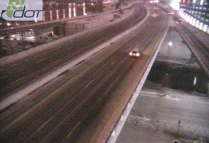
6:38 p.m. Tuesday: Roads are steadily improving in Rhode Island.
Road conditions continue to improve. Drive cautiously on ramps and secondary roads we're still working on. #JunoRI
5:05 p.m. Tuesday:
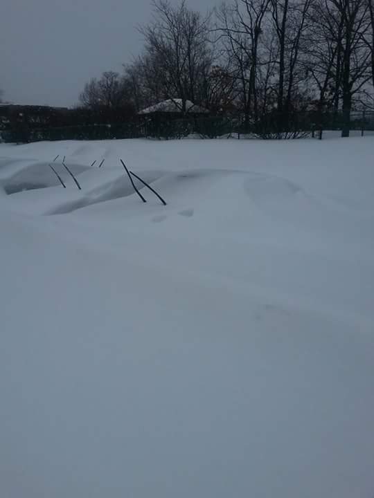
Even better one from my uncle in Worcester, MA! His car is under there! @breakingweather
4:09 p.m. Tuesday:
4:00 p.m. Tuesday:
Nighttime & daytime views of the #blizzardof2015 from @NOAASatellites & @NASANPP: http://go.nasa.gov/18qvFDh

2:42 p.m Tuesday:
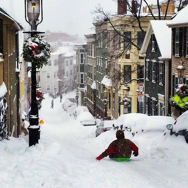
[2p] Pleasant Street, Charlestown (photo courtesy of Sarah Levy ... & yes, wreaths are still up)
 (Photo/MaineDOT)
1:38 p.m. Tuesday:
 One Middletown, Conn., resident woke to snow completely covering vehicles and local roads. (Instagram Photo/didi_922)
12:07 p.m. Tuesday: Framingham, Massachusetts, recorded 30 inches of snow as of 12 p.m. Tuesday. Atkinson, New Hampshire, also received more than two feet of snow, hitting the 26 inch mark. Waterford, Connecticut, topped 23 inches.
11:31 a.m. Tuesday: All National Grid customers in Nantucket, Massachusetts, are without power amid violent storm conditions. The company reported they are currently working to restore power to more than 12,800 in the area.
11:03 a.m. Tuesday:
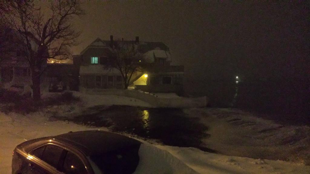
 High tide in Marshfield, Mass., caused structural damage to a local home Tuesday morning. (Photo/Marshfield Police Department)
10:21 a.m. Tuesday: "Rounds of windswept snow will continue over much of southern and eastern New England through the day Tuesday with mountainous drifts in some areas. Travel remains dangerous in many areas. A couple of bursts of heavy snow can still occur farther to the west from New York City to Philadelphia into the afternoon," AccuWeather.com Meteorologist Alex Sosnowski said.
"Strong winds will continue to cause blowing and drifting snow in southern and eastern New England after the snow tapers off Tuesday night into Wednesday morning," he said.
10:08 a.m. Tuesday: In Worcester, Massachusetts, residents woke to more than 20 inches of snow burying vehicles on local streets.
 Communities
across New England were slammed with heavy snow amid the first blizzard
to hit the Northeast this year. (Instagram Photo/dphalpin)
Communities
across New England were slammed with heavy snow amid the first blizzard
to hit the Northeast this year. (Instagram Photo/dphalpin)9:07 a.m. Tuesday: Snow amounts have totaled near 24 inches in some areas according to the National Weather Service. As of 9 a.m. Tuesday, 23.5 inches was reported in Auburn, Massachusetts. In Rhode Island, West Gloucester hit 16.6 inches, and Marlborough, Connecticut, received 13.8 inches as of this morning.
8:02 a.m. Tuesday:
 Snow-covered roadways and vehicles in the Boston area Tuesday morning. (Photo/takumamusic)
6:10 a.m. Tuesday:
RT @acme401: @NWSBoston waves over the seawall in Winthrop (Harbor side)
5:56 a.m. Tuesday:
5:38 a.m. Tuesday: Flooding continues in Massachusetts.
5:33 a.m. Tuesday: More than 9,100 Massachusetts electric customers are without service at this hour, utilities report.
5:18 a.m. Tuesday: Mail delivery is canceled Tuesday from the New Jersey shore to Maine's Down East region, affecting the cities of New York City; Boston; Providence, Rhode Island; Hartford, Connecticut; and Portland, Maine; the United States Postal Service said.
4:51 a.m. Tuesday: Worcester, Massachusetts, firefighters battled fire and blizzard conditions early Tuesday.
All hands working. Defensive operations. Fighting high winds and blizzard conditions. #Worcester
4:44 a.m. Tuesday: Tidal flooding occurring in Quincy, Massachusetts, Quincy police report.
4:38 a.m. Tuesday:
4:33 a.m. Tuesday: Whiteout conditions with blowing and drifting snow on Route 3, Bedford, Massachusetts, 511MA webcam shows.

4:19 a.m. Tuesday: MesoWest reported, a 68-mph gust at Otis Air National Guard Base, Massachusetts.
4:12 a.m. Tuesday: One death reported in New York from the storm.
4:06 a.m. Tuesday: Heavy snow continues to fall in Boston with winds causing drifting snow and taking AccuWeather.com RealFeel® Temperatures down to -14 F.
4:03 a.m. Tuesday: More than 4,400 U.S. flights have been canceled Tuesday with another 200 already canceled for Wednesday, FlightStats reports.
3:51 a.m. Tuesday: At Islip Airport, New York, 14.7 inches of snow have fallen, a FAA contract observer reported; 10.8 inches of snow have fallen in Marlborough, Connecticut, a NWS spotter reported.
3:31 a.m. Tuesday: More than 5,400 Massachusetts electric customers, mostly in the National Grid service area, are without service at this hour, utilities report.

3:17 a.m. Tuesday: Blizzard conditions occurring in Islip, New York, with blowing snow and visibility at one-eighth of a mile. Picture below from 511NY webcam from I-495/Waverly Avenue. Islip broke its Jan. 26 snow record with 7.5 inches; the old record was 4.5 inches set in 1987.

3:11 a.m. Tuesday: Infrared image from the GOES satellite showing the blizzard off the New England coast. (Photo/NOAA).

2:51 a.m. Tuesday: More than 1,700 Massachusetts electric customers are without service, utilities report.
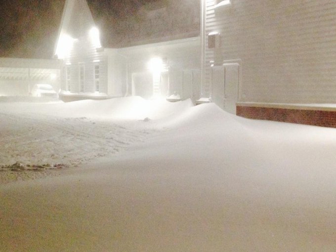
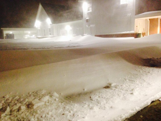
2:44 a.m. Tuesday: Up to 3-foot snow drifts reported in Massachusetts.
@WX1BOX @NWSBoston impossible 2-3 foot drifts
2:36 a.m. Tuesday: Heavy snow falling at West Hartford, Connecticut, CTDOT webcam shows.

2:23 a.m. Tuesday: Heavy snow and blowing snow on I-93/Route 138, Canton, Massachusetts, 511MA webcam shows.

2:03 a.m. Tuesday: Blowing snow reported at John F. Kennedy International Airport, New York City.

1:22 a.m. Tuesday: Quarter-mile visibility with heavy and blowing snow at Logan Airport, Boston, according to NWS observation.

1:09 a.m. Tuesday: More than 1,000 Nantucket, Massachusetts, customers are without power, National Grid reports.
12:16 a.m. Tuesday: MesoWest reports, a 69-mph gust clocked at Nantucket Memorial Airport, Massachusetts.
12:05 a.m. Tuesday: New York City firefighters had to battle high winds to control a building fire late Monday night.
11:44 p.m. Monday: Plowing continues on NY 110 at NY 27 in Suffolk County, 511NY webcam shows.

11:13 p.m. Monday: More than 4,200 U.S. flights have already been canceled for Tuesday, FlightStats reports.
11:05 p.m. Monday: New York travel ban is underway.
11:00 p.m. Monday: Half-mile visibility reported in Boston from heavy snow band. EarthCam shows reduced visibility from its Boston camera.

10:51 p.m. Monday: Over a foot of snow is still expected to fall in New York City through Wednesday.

10:36 p.m. Monday: Rhode Island has industrial-sized equipment ready to help clear snow.
We'll be putting this blower to work; it moves up to 1,800 tons of snow per hour! @GinaRaimondo @RhodeIslandEMA
10:33 p.m. Monday: Shelters and warming shelters will open Tuesday across Rhode Island, the Rhode Island Emergency Management Agency said.
10:30 p.m. Monday:
10:27 p.m. Monday: Currently, the road conditions on the Massachusetts Turnpike are poor, Massachusetts State Police reported on their website. All barracks are dealing with spin-outs and cars off the road. No injuries have been reported. The speed limit is 40 mph. A travel ban takes effect at midnight Tuesday in Massachusetts.
10:10 p.m. Monday: Transit in New Jersey shuts down for the blizzard.
10:03 p.m. Monday: Snow rates could surpass 2 inches per hour in Long Island from a band of heavy snow, AccuWeather.com Meterorologist Brian Lada said.

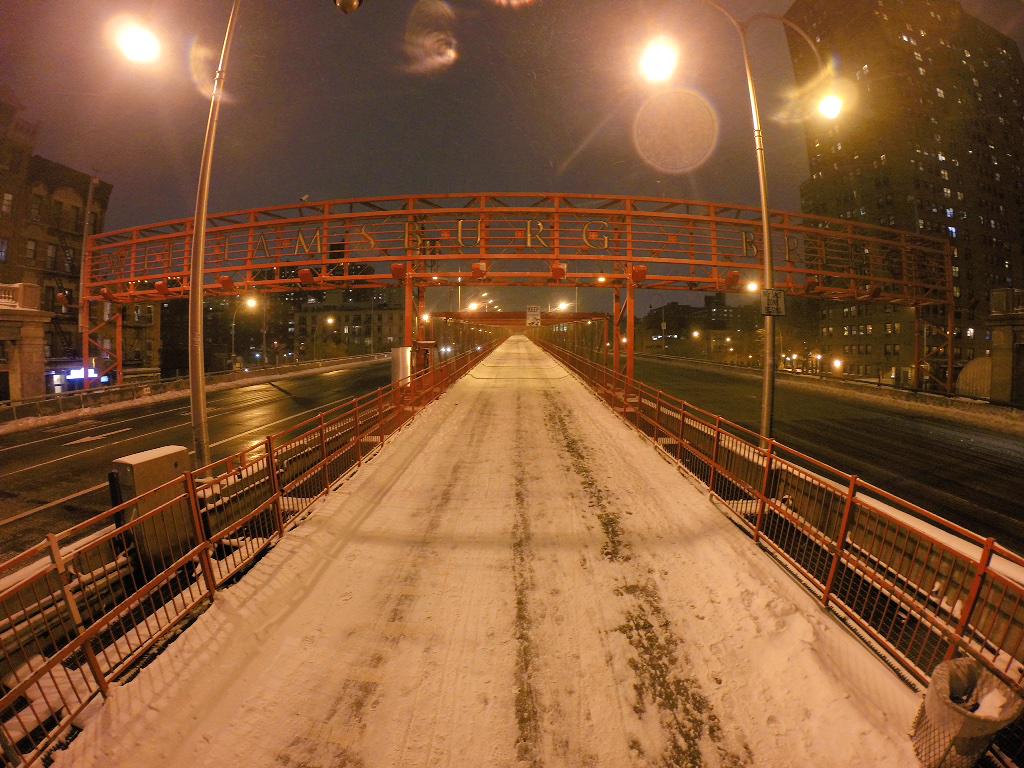
9:35 p.m. Monday
Not a single soul on the Williamsburg Bridge right now in New York City #blizzardof2015
During the rest of the night, AccuWeather.com meteorologists expect the storm to continue to spread along the rest of Long Island, New York City; Hartford, Connecticut; and Worcester and Boston; Massachusetts, right through the first half of the day tomorrow, he added.
6:58 p.m. Monday:
6:46 p.m. Monday: Watch the 6 p.m. edition of AccuWeather LIVE.

5:56 p.m. Monday:
 Snow falling throughout New York City earlier this evening. (Photo/Stephen McCloud, Baron Employee)
5:47 p.m. Monday:
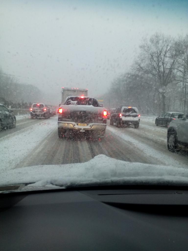
On the Long Island Expressway trying to get back to the city. Moving at 5 mph. Snow piling up and road not plowed.
3:56 p.m. Monday:
 Traffic is slow on the Long Island Expressway. (Photo James Ford/PIX11News/Blizzard)
3:41 p.m. Monday:

3:14 p.m. Monday:

3:00 p.m. Monday:
2:10 p.m. Monday: To assist those leaving early from work due to winter weather, 26 trains have been added to New York's Long Island Railroad and Metro-North schedules this afternoon. According to an MTA service advisory, "Bus, commuter-rail, and subway service could be curtailed on a route-by-route basis, depending on conditions and snow-removal operations."
1:39 p.m. Monday: The NBA has postponed the New York Knicks' and Brooklyn Nets' home games scheduled for Monday night in anticipation of the winter weather.
1:01 p.m. Monday: The New York Stock Exchange has vowed to remain open Monday and Tuesday despite the storm:
The NYSE is prepared for #Snowmageddon2015, & will remain open for normal trading hours today & tomorrow
12:51 p.m. Monday: All Massachusetts Bay Public Transport will be canceled Tuesday:
12:00 p.m. Monday:















No comments:
Post a Comment